What We Do
Accountability From Every Altitude
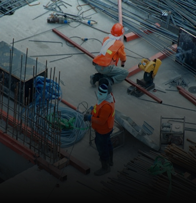
Construction projects move fast. Disputes happen. Delays compound. Aerial progress documentation gives contractors, owners, and lenders a consistent, objective visual record at every phase,from site prep through final envelope closure.
Our certified pilots capture orthomosaic maps, 3D point clouds, and radiometric thermal imagery across active construction sites. Combined in a single structured report, this data doesn't just document what's been built, it reveals what can't be seen from the ground.

What We Offer
Documentation Capabilities
Every construction progress report is scoped to your project phase and stakeholder requirements. Our certified pilots and thermographers capture what matters, systematically, safely, and on schedule.
Milestone-by-Milestone Aerial Documentation
Scheduled flights tied to your project milestones — framing, roofing, envelope, and mechanical rough-in, providing a consistent visual record that aligns with draw schedules and inspection sign-offs.
Orthomosaic & 3D Site Mapping
High-resolution orthomosaic maps and 3D point cloud models of the entire site giving project managers accurate, measurable overviews of site conditions at every phase.
Thermal Checks During Active Construction
Radiometric thermal imaging during framing and envelope installation to detect insulation voids, air barrier deficiencies, and moisture intrusion before they're sealed behind cladding.
Stockpile Volume Calculations
Accurate volumetric measurements of material stockpiles, aggregate, soil, and demolition debris, using photogrammetric modeling to support inventory tracking and billing reconciliation.
As-Built Comparison Documentation
Side-by-side aerial imagery against project drawings to flag deviations from design intent early — reducing costly rework and supporting deficiency management before substantial completion.
Stakeholder-Ready Progress Reports
Clear, professionally formatted reports with annotated imagery, orthomosaic maps, thermal findings, and a milestone summary, ready to distribute to owners, lenders, and project managers within 48 hours.
Thermal Advantage
What Thermal Reveals During Construction
Most construction deficiencies are invisible until they're expensive. Thermal imaging during active build phases catches problems while corrections are still straightforward, not after the cladding is on and the warranty has run out.
- Insulation voids and gaps behind framing
- Air barrier discontinuities at penetrations and transitions
- Moisture trapped in substrates before envelope closure
- Improper vapour barrier installation at critical junctions
- Thermal bridging through structural connectors and lintels
- Radiant heat anomalies indicating curing or settlement issues
CATCH IT BEFORE IT'S
CLOSED IN.
Once the cladding is installed and the walls are sealed, fixing a thermal deficiency means tearing out finished work. Our mid-construction thermal scans identify these issues when a single crew visit resolves them — not a $40,000 remediation.
Request a QuoteHow It Works
The Process
Request & Scope
Share your project timeline, current phase, and documentation goals. We review site plans, access constraints, and airspace conditions to define the right flight and reporting scope.
Mission Planning
We map optimal flight paths for full site coverage, confirm thermal windows for any infrared phases, and coordinate all required airspace authorizations with Nav Canada.
Aerial Documentation
Certified pilots deploy on your scheduled milestone dates to capture high-resolution RGB imagery, orthomosaic data, and thermal coverage across the entire active site.
Detailed Report
A professionally structured progress report with annotated aerial imagery, orthomosaic maps, thermal findings where applicable, and a milestone summary — delivered within 48 hours.
Transport Canada
Advanced RPAS Certified
ITC Level I
Infrared Thermography Expert
CARs 901
Regulation Compliant Operations
Level 1 Complex Ops
High-Risk Flight Certified


ADVANCED DRONE SOLUTIONS FOR INDUSTRIAL, COMMERCIAL & CONSTRUCTION OPERATIONS
Providing professional aerial progress documentation, orthomosaic mapping, thermal construction checks, and stakeholder reporting across Vancouver & the Lower Mainland. Certified pilots, rapid deployment, and fully insured operations you can rely on.